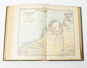
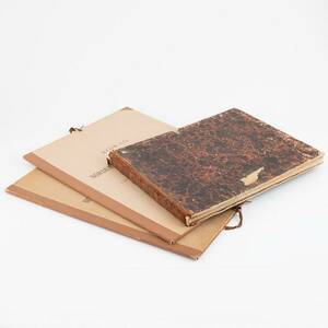
Stielers Hand-atlas 1905 100 maps
STIELERS HAND-ATLAS. Stielers Hand-Atlas. Ed. Justus Perthes´ Geographischer Anstalt. 9 ed. Gotha (Justus Perthes) 1905. See text.
- 2018-03-09 00:00:00
- Stockholms Auktionsverk
- Länk till objektet
Slutpris:650 SEK
Avslutade auktioner liknande Stielers Hand-atlas 1905 100 maps
Stielers Hand-Atlas 1834 & Bidrag till Nordens äl...
Adolf Stieler: Hand-Atlas über alle theile der Erde. Gotha, Justus Perthes, 1834. Tvär folio. 37 x 45,5 cm. 63 graverade gränskolorerade planscher (grav. titel + Läs mer...
- 2024-06-16
- Bukowskis
- 1 800 SEK

Hand-atlas, Stielers
Stielers, 1851. Längd: 37,5 cm, djup: 46 cm, höjd: 3 cm. Läs mer...
- 2022-04-04
- Metropol
- 2 800 SEK

Adolf Stieler's Hand-Atlas, handkoloriert
Adolf Stielers Hand-Atlas über alle Theile der Erde und über das Weltgebäude Gotha, Justus Perthes, um 1900, handkolorierte Tafeln, Halbleder, gebunden, Goldprägung, mit Leder verstärkte Läs mer...
- 2019-07-24
- Lauritz - Hamburg
- 40 EUR

Homann Hand Atlas 1754 together with 10 more maps
COMPOSITE ATLAS. HOMANN, J. B. Bequemer Handatlas .... Nürnberg 1754. . Maps in various conditions, damages and repairs, spotting etc. See text. Läs mer...
- 2019-03-17
- Stockholms Auktionsverk
- 14 500 SEK

Atlas the Netherlands Fricx 1712
ATLAS OF THE NETHERLANDS. FRICX, Eugène-Henri. Table des cartes des Pays Bas et des frontieres de France [...]. Brussels 1712. Not complete. All maps partly Läs mer...
- 2021-03-21
- Stockholms Auktionsverk
- 3 000 SEK

Stielers Hand-Atlas 1918
STIELERS, Hand-Atlas, 100 Karten in Kupferstick mit 162 Nebenkarten, 9:e upplaga, pärm med pressad dekor i jugend samt kopparplakett, folio, ca 40,5x26 cm. Pärm Läs mer...
- 2016-03-29
- Stockholms Auktionsverk
- 500 SEK
![18th century celestial atlas Johann Gabriel Doppelmayr Atlas Coelestis in quo Mundus Spectabilis et in eodem Stellarum [...]. 1742. 40 other mapstables.](https://bilder.xn--vadrdenvrd-s5af.se/1662428-18th-century-celestial-atlas-johann_300.jpg)
18th century celestial atlas: Johann Gabriel Doppe...
Johann Gabriel Doppelmayr: Atlas Coelestis in quo Mundus Spectabilis et in eodem Stellarum omnium Phoenomena [...]. 3 parts, compilation. Nuremberg: Homanns Heirs 1742[-46]. Elephant folio. Läs mer...
- 2014-06-03
- http://www.bruun-rasmussen.dk - Baltikavej
- 48 000 DKK

Stielers Hand=Atlas A193
Mått L.B.H. ca 41x27x6cm Läs mer...
- 2019-08-18
- Jämtloppan
- 190 SEK

Composite atlas Homann and Swedish maps
COMPOSITE ATLAS. HOMANN, JOHANN BAPTIST. Atlas minor XXXVI. tabularum Homannianarum coloribus methodice distinctarum. - Kleiner Atlas von sechs und dreyssig außerlesenen Homanns-Karten. Nürnberg after 1744. Läs mer...
- 2019-03-17
- Stockholms Auktionsverk
- 6 000 SEK

Atlas Homann 18 maps c. 1720-30
COMPOSITE ATLAS. HOMANN, JOHANN BAPTIST.(Composite atlas with 18 handcoloured double-page engraved maps, published in Nürnberg c. 1720-30. See text. Läs mer...
- 2019-03-17
- Stockholms Auktionsverk
- 13 000 SEK