Maps of ports America and West Indies 3 maps
PORTS OF AMERICA (NEW YORK) & WEST INDIES (3). 2 maps with different ports, c. 240x325 mm. Paris c. 1750. Engraved by Desbruslins. Some dampstaining to margins.
- 2020-09-20 00:00:00
- Stockholms Auktionsverk
- Länk till objektet
Slutpris:16 500 SEK
Avslutade auktioner liknande Maps of ports America and West Indies 3 maps

Guides etc, Mexico and South America, 11 vol.
GUIDES ETC, MEXICO AND SOUTH AMERICA (11). FAIRFORD. Peeps at Many Lands. Cuba. With Twelve Full-Page Illustrations in Colour by Claude Pratt. London, 1913 (somewhat Läs mer...
- 2020-03-29
- Stockholms Auktionsverk
- 450 SEK

The Confederate States of America Catalog and hand...
of Stamps and Postal History av Confederate Stamp Alliance. Halvfransk inbindning, 2012, 528 sidor. The catalog covers numerous facets of Confederate Philately: Postmaster Provisionals, Handstamped Läs mer...
- 2024-08-26
- Göta Frimärken
- 2 200 SEK

Travel guides, 55 vol.
TRAVEL GUIDES (55). Lot consisting of travel guides, maps, brochures, souvenirs etc. Specific countries and general. Different languages, 19th and 20 centuries. Among those: FETRIDGE. Läs mer...
- 2020-03-29
- Stockholms Auktionsverk
- 4 800 SEK

Three maps of The Netherlands and South America
MAPS, (3), all published by LAURIE & WHITTLE, London:. All with central folding marks and margin tears to the fold. A new map of the Läs mer...
- 2019-03-11
- Stockholms Auktionsverk
- 1 400 SEK

South America 6 smaller maps Bonne
MAPS SOUTH AMERICA (6). BONNE. 7 coloured engraved maps, c. 225x325 mm. . Partly dampstained and browned, centrefold as issued. Läs mer...
- 2020-09-20
- Stockholms Auktionsverk
- 900 SEK

Three maps of The Netherlands and South America
MAPS, (3), all published by LAURIE & WHITTLE, London:. All with central folding marks and margin tears to the fold. A new map of the Läs mer...
- 2017-11-12
- Stockholms Auktionsverk
- 450 SEK

Anson map of South America
MAP OF SOUTH AMERICA . ANSON, GEORGE. A chart of the southern part of South America : with the track of the Centurion from the Läs mer...
- 2020-09-20
- Stockholms Auktionsverk
- 2 400 SEK

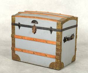
Koffert Amerika 1900-tal
Så kallad "Amerika-koffert" från sekelskiftet 1800/1900-tal Trästomme med metallbeslag Märkt på låset: Eagle Lock Co Terryville Skrivet på toppen av locket: Orion Henry Co Illinois Läs mer...
- 2021-09-30
- Norrlands Auktionsverk
- 500 SEK

South America map by Blome 1690
SCARE MAP OF SOUTH AMERICA. BLOME, RICHARD. A New Mapp of America Meridionale Designed by Monsieur Sanson Geographer to the French King... London, c. Läs mer...
- 2021-03-21
- Stockholms Auktionsverk
- 1 700 SEK

Composite atlas Homann and Swedish maps
COMPOSITE ATLAS. HOMANN, JOHANN BAPTIST. Atlas minor XXXVI. tabularum Homannianarum coloribus methodice distinctarum. - Kleiner Atlas von sechs und dreyssig außerlesenen Homanns-Karten. Nürnberg after 1744. Läs mer...
- 2019-03-17
- Stockholms Auktionsverk
- 6 000 SEK