Map of Rome by Halma after Falda 1704
MAP OF ROME. FALDA, G. B. Novissima et accuratissima delineatio Romae veteris et tabula topographica delineatore Ioanne Baptista Falda / Niewe en naukeurige afbeeldning van Oud en niew Rome... Amsterdam, F. Halma, no date (1704).Engraved map with bird's eye view of Rome, with large figurative cartouche and many other images, text on both sides. About 495x640 mm. Images engraved by I v. Vianen. Framed. Later edition.The map is based on Falda's "Nuova pianta et alzata della citta di Roma", originally published in a 12-sheet map with views in 1676.
- 2016-09-14 20:32:00
- http://www.stadsauktion.se
- Länk till objektet
Slutpris:3 200 SEK
Avslutade auktioner liknande Map of Rome by Halma after Falda 1704

Karta Västerbotten 1800-tal
Karta över Västerbottens län Sammandragen och författad av P.A Kjellerstedt 1870-1878 Kartans mått: 100 x 71 cm Konditionsrapport: Bruks- och åldersbaserat slitage, veck, revor och Läs mer...
- 2022-03-31
- Norrlands Auktionsverk
- 550 SEK

Anson map of South America
MAP OF SOUTH AMERICA . ANSON, GEORGE. A chart of the southern part of South America : with the track of the Centurion from the Läs mer...
- 2020-09-20
- Stockholms Auktionsverk
- 2 400 SEK

South America map by Blome 1690
SCARE MAP OF SOUTH AMERICA. BLOME, RICHARD. A New Mapp of America Meridionale Designed by Monsieur Sanson Geographer to the French King... London, c. Läs mer...
- 2021-03-21
- Stockholms Auktionsverk
- 1 700 SEK

Bok 'Accurata e succinta descrizione topografica d...
Accurata e succinta descrizione topografica delle Antichitá di Roma... Parte 1 In Roma MDCCCXXIV (1824) Skriven av Ridolfino Venuti Mått: 28,5 x 22 cm Konditionsrapport: Läs mer...
- 2020-11-26
- Norrlands Auktionsverk
- 1 200 SEK

Map of Russia by Bonne
MAP OF RUSSIA. BONNE, R. Partie orientale de l´Empire de Russie. Paris, chez Lattré, 1781-1800. . Centrefold browned. . Läs mer...
- 2021-05-03
- Stockholms Auktionsverk
- 600 SEK

World map by Danckerts c. 1680
WORLD MAP. DANCKERTS, JUSTUS. Nova Totius Terrarum Orbis Tabula. Amsterdam C. 1680. Map trimmed into plate area, lacking a few millimeters of plate, no margins. Läs mer...
- 2021-03-21
- Stockholms Auktionsverk
- 17 000 SEK

Homann map of Rome c. 1720
ROME. HOMANN, JOHANN BAPTIST (1633-1724). Urbis Romae veteris ac modernae accurata delineato... Nuremberg (J.B.Homann) c. 1720. Partly browned, centrefold with split. Läs mer...
- 2020-04-18
- Stockholms Auktionsverk
- 3 000 SEK

Map on China by Bowen 1740
BOWEN, EMANUEL. A New & Accurate Map of China Drawn from Surveys Made by the Jesuit Missionaries, by Order of the Emperor ... London (Harris) Läs mer...
- 2019-12-29
- Stockholms Auktionsverk
- 3 800 SEK

Map of Ukraine by Seutter ca 1740
UNCOMMON MAP OF UKRAINE. SEUTTER, M. Amplissima Ucraniae Regio, Palatinus Kioviensem et Braclaviensem Complectens, Cum adjacentibut Provinciis juxta... Augsburg ca 1740. Centrefold as issued, Läs mer...
- 2020-09-20
- Stockholms Auktionsverk
- 4 000 SEK

China 1848, 2 vol.
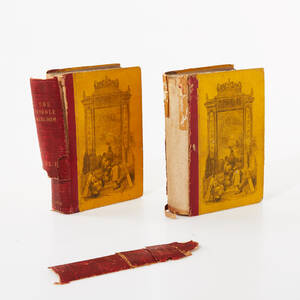
CHINA 1848 (2). WILLIAMS, SAMUEL WELLS. The Middle Kingdom, a Survey of the Geography, Government, Education, Social Liofe, Arts, Religion, &c. of the Chinese Empire Läs mer...
- 2020-04-29
- Stockholms Auktionsverk
- 400 SEK