
Shirleys World Maps
SHIRLEY RODNEY W. The Mapping of the World. Early printed World Maps 1472-1700. London (New Holland Ltd) 1993. . 216567.
- 2013-12-16 00:00:00
- Stockholms Auktionsverk
- Länk till objektet
Slutpris:2 000 SEK
Avslutade auktioner liknande Shirleys World Maps

Shirley Mapping of the world 1984
OM KARTOR. SHIRLEY, R. W. The mapping of the world. Early printed world maps, 1472-1700. London (Holland Press Cartographica) 1987. Delvis nött band, spricka i Läs mer...
- 2021-03-21
- Stockholms Auktionsverk
- 800 SEK

Shirley Mapping of the world 1984
OM KARTOR. SHIRLEY, R. W. The mapping of the world. Early printed world maps, 1472-1700. London (Holland Press Cartographica) 1984. Lätt nött omslag. Läs mer...
- 2020-11-05
- Stockholms Auktionsverk
- 2 600 SEK

Composite atlas Homann and Swedish maps
COMPOSITE ATLAS. HOMANN, JOHANN BAPTIST. Atlas minor XXXVI. tabularum Homannianarum coloribus methodice distinctarum. - Kleiner Atlas von sechs und dreyssig außerlesenen Homanns-Karten. Nürnberg after 1744. Läs mer...
- 2019-03-17
- Stockholms Auktionsverk
- 6 000 SEK

Atlas fragment by Homann ca 1744
ATLAS FRAGMENT. HOMANN, J. B. Atlas novus. C. 1744. Heavily worn with damages and losses, mostly to margins and corners, but also sometimes to centrefolds, Läs mer...
- 2020-03-15
- Stockholms Auktionsverk
- 5 000 SEK

Peary in Greenland, 2 vol.
PEARY IN GREENLAND (2). PEARY, ROBERT EDWIN. Northward over the "Great Ice". A Narrative of Life and Work along the Shores and upon the Interior Läs mer...
- 2019-11-29
- Stockholms Auktionsverk
- 600 SEK

World map Playfair:s Geography ca 1840
WORLD MAP. DR PLAYFAIR. Two engraved maps, Eastern and Northern Hemisphaere, about 460x1000 mm in total. London 1840. Engraved by B. Smith and E. Jones.Framed Läs mer...
- 2016-12-01
- http://www.stadsauktion.se
- 1 000 SEK

World map Playfair:s Geography ca 1840
WORLD MAP. DR PLAYFAIR. Two engraved maps, Eastern and Northern Hemisphaere, about 460x1000 mm in total. London 1840. Engraved by B. Smith and Läs mer...
- 2016-12-25
- Stockholms Auktionsverk
- 1 000 SEK
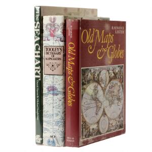
Mapmaking: Collection of 32 vols. on maps and char...
Colelction of 32 vols. on maps and charts, incl. Skelton: Decorative Maps. London 1966. Lated ed. + R.W. Shirley: The mapping of the world. London Läs mer...
- 2013-04-16
- http://www.bruun-rasmussen.dk - Baltikavej
- 2 900 DKK

Samling skolekort. Norden, Østens Rige, Europa. (...
Samling skolekort. Kort over Norden. Liber Kartor. Stockholm 2003. 1:1300000. H. 185 B. 150 cm. Brugsspor, folder, papirskade, blyantstreger. Historisk kort over Østens riger. Ægypten, Läs mer...
- 2016-04-21
- Lauritz - Herlev, DK
- 650 DKK
Around the world: Large collection of more than 85...
Large collection of more than 85 maps and city maps (Austria, Holland, Switzerland, Germany, China, Africa, Thailand, UK, USSR, Mexico, Peru, Poland, Cuba, United States, Läs mer...
- 2012-11-11
- http://www.bruun-rasmussen.dk - Baltikavej
- 1 650 DKK