Map of North Europe, including Poland
SCHMIDT, J. M. F. Wege-Karte vom Nord-Östlichen Europa, enthaltend, die Länder zwischen der Oder und Wolga, dem Ladoga See und dem Ursprunge des Przypietz. Berlin (Simon Schropp et Comp.) no date (about 1820).Partly coloured engraved map by H. Kliewer and C. Jättnig after Schmidt. About 615x755 mm. Some minor spots. On upper margin label "Piqouet, a Paris".Detailed map of the North-Eastern part of Europe, including Prussia, Poland, Russia, Estonia, Latvia, Lithuania, Sweden and Finland.Karta.
- 2014-03-09 15:36:00
- http://www.stadsauktion.se
- Länk till objektet
Slutpris:800 SEK
Avslutade auktioner liknande Map of North Europe, including Poland

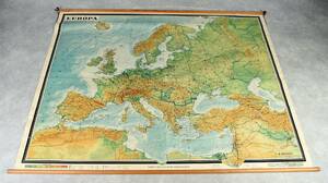
Europakarta 1950-tal
Vägghängd karta över Europa. Kartografi, reproduktion & tryck: Karl Wenschow G.M.B.H Munchen. Mått: 213 x 176 cm Konditionsrapport: Märken, mindre revor & bruksslitage, Inga övriga Läs mer...
- 2022-09-01
- Norrlands Auktionsverk
- 500 SEK

Bowen map of the North Pole c. 1750
THE NORTH POLE. BOWEN, EMANUEL. A new & accurate map of the North Pole with all the countries hitherto discovered. Situated near or adjacent to Läs mer...
- 2019-11-14
- Stockholms Auktionsverk
- 1 000 SEK

Kitchen A correct map of Europe in 2 leaves
EUROPE NORTHEN PART (2). KITCHEN. A correct map of Europe divided into its empires and kingdoms. Drawn from the most improved maps and charts. London Läs mer...
- 2019-03-17
- Stockholms Auktionsverk
- 300 SEK

Nautical chart of America by Norie & Wilson
NORTH AMERICA. NORIE & WILSON. Chart of North America from Boston to Cape Look Out including New York, Delaware, Chesapeake &c. London, Norie & Wilson, Läs mer...
- 2021-04-19
- Stockholms Auktionsverk
- 2 200 SEK

Lloyd´s Field Sports 1830, 2 vol.
LLOYD´S FIELKD SPORTS 1830 (2). LLOYD, LLEWELLYN. Field Sports of the North of Europe, Comprised in a Personal Narrative of a Residence in Sweden and Läs mer...
- 2020-12-27
- Stockholms Auktionsverk
- 4 800 SEK

Wallis´s Tour of Europe map 1794
WALLIS, JOHN. Wallis´s Tour of Europe A New Geographical Pastime. London 1794. . Dissected and mounted on linen, spotting, owner´s signature in one corner. Läs mer...
- 2019-12-03
- Stockholms Auktionsverk
- 1 000 SEK

Four 18th century maps of Eastern Europe
MAPS, (4), all published by LAURIE & WHITTLE, London:. All with central folding marks. A New Map of the Electorate of Bavaria and A New Läs mer...
- 2019-03-09
- Stockholms Auktionsverk
- 1 800 SEK

De Fer's map of Russia, Eastern Europe, Turkey etc
MAP OF THE GREAT NORTHERN WAR. DE FER, N. Carte pour l'Intelligence des Affaires Presente des Turcs ... et des Moscovites aux Environs de la Läs mer...
- 2015-02-19
- http://www.stadsauktion.se
- 900 SEK

Map of North Africa and Arabian Golf 1805
MAP OF ARABIAN GOLF - NORTH AFRICA. BRUCE, J. Carte du Golf d´Arabie depuis Suez á Bab-El-Mandeb.... Paris 1805. Cut into platemark, spotting and soiling, Läs mer...
- 2019-05-11
- Stockholms Auktionsverk
- 600 SEK

Engelsk verdens atlas af J. Rusell 1799 (28)
Engelsk verdens atlas med 28 håndkolorerede kobberstukne kort over hele verden af J. Rusell 1799. Halvlæderbind med 28 kort bestående af: Map of the World Läs mer...
- 2015-06-15
- Lauritz - DK, Næstved, Gl. Holstedvej
- 7 200 DKK